From space, it’s not our cities that stand out as a mark of human impact on our planet. It’s our farms. Farming has changed our planet, but farming itself is changing. By 2050, we need to be able to produce 70% more food whilst also addressing today’s global challenges: population growth, climate change, and water scarcity.
Every plant is unique. Each has different needs. What we call “precision agriculture” starts with this simple insight. The better you target your use of water, fertilizer, herbicides, even down to the level of an individual plant, the less you waste and the smaller your resource footprint.
The interesting thing is not just figuring out what one plant needs, but doing it on the scale of a million plants. This is where imaging can help. Capturing the detail, but from a distance. Some farmers already used drones or other aircraft to do just that. But these are not tools available to all. I want to ask what if precision agriculture could be a service accessible to anyone on the planet?
The sheer scale of farming means that any imaging technology needs to be compact and robust enough to be placed on satellite, but also powerful enough to be able to zoom right in. This is the challenge that we’ve taken on in our lab at Imperial College, and we’re trying to solve it using lasers.

All matter has its own unique signature that sits somewhere on the electromagnetic spectrum. The green color of a leaf is a signature of the light-harvesting chemistry it contains. But the colors of visible light are only a small part of the electromagnetic spectrum. There are useful signatures spread all across it from the ultraviolet, to the infrared, and beyond.

For crop farmers, these signatures can help identify water stress, the earliest signs of a pest outbreak. And crucially, whether each plant is actively growing towards maturity. This information can be used to act earlier and smarter to optimize yields. All you need to do is to be able to tune in regularly to read the right parts of the spectrum.
Today, we have satellites that use this approach to monitor plant health. But the majority of today’s satellite-based imaging technology is passive. It can only collect reflected sunlight that escapes back into space. This limits the resolution obtainable, and means it can only be used in the daytime. This leaves data vulnerable to error, minimizes what you can see, and means you can’t zoom in to the level of individual plants. And this is where lasers come in.

By actively sending a beam of light back to the Earth, we can get 24-hour coverage and create 3D images from the canopy down to a single plant on the ground. Because the beam is intense, we can cut through weather and atmospheric distortion. And because the beam is carefully controlled, we get the accuracy we need to precisely map each plant to reveal plant patterns across each field.
The challenge has been to find the right laser material for the job. Our research is based on alexandrite, a laser type which has been around since the 1970s. What makes it intriguing is that it’s tunable to precisely read the indicators of plant health.
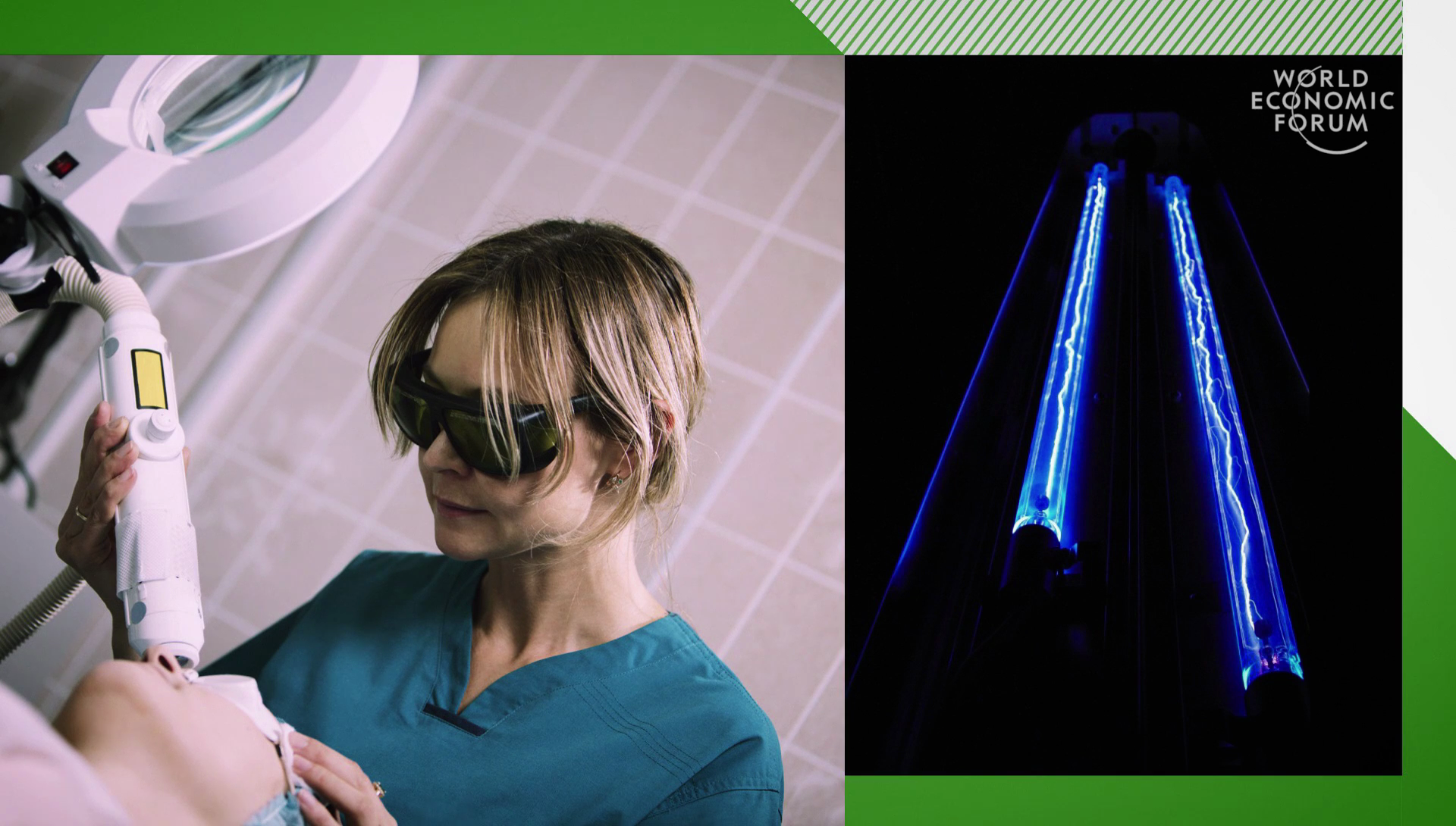
Today, alexandrite lasers are most often seen in the cosmetic industry. These are large, immobile machines which need bulky and inefficient lamps to work. This is hardly suitable for space, where tech needs to be compact and robust enough to last for years. But in our lab, we’ve been able to re-engineer alexandrite lasers. By taking advantage of advances in commercial tech which has been designed for the laser display market, we’ve been able to replace these lamps with a device that can be up to ten times more efficient. Our device is small enough to fit in your palm, but robust enough to go into space.
Placed on an orbiting satellite, our laser can not only determine the extent of vegetation across the planet but also key health information including disease, drought, and deforestation. If we can make this widely available, this could be significant for areas of limited resources, but valuable for everyone from governmental monitoring of deforestation to the loan farmer maximizing his crop yield.
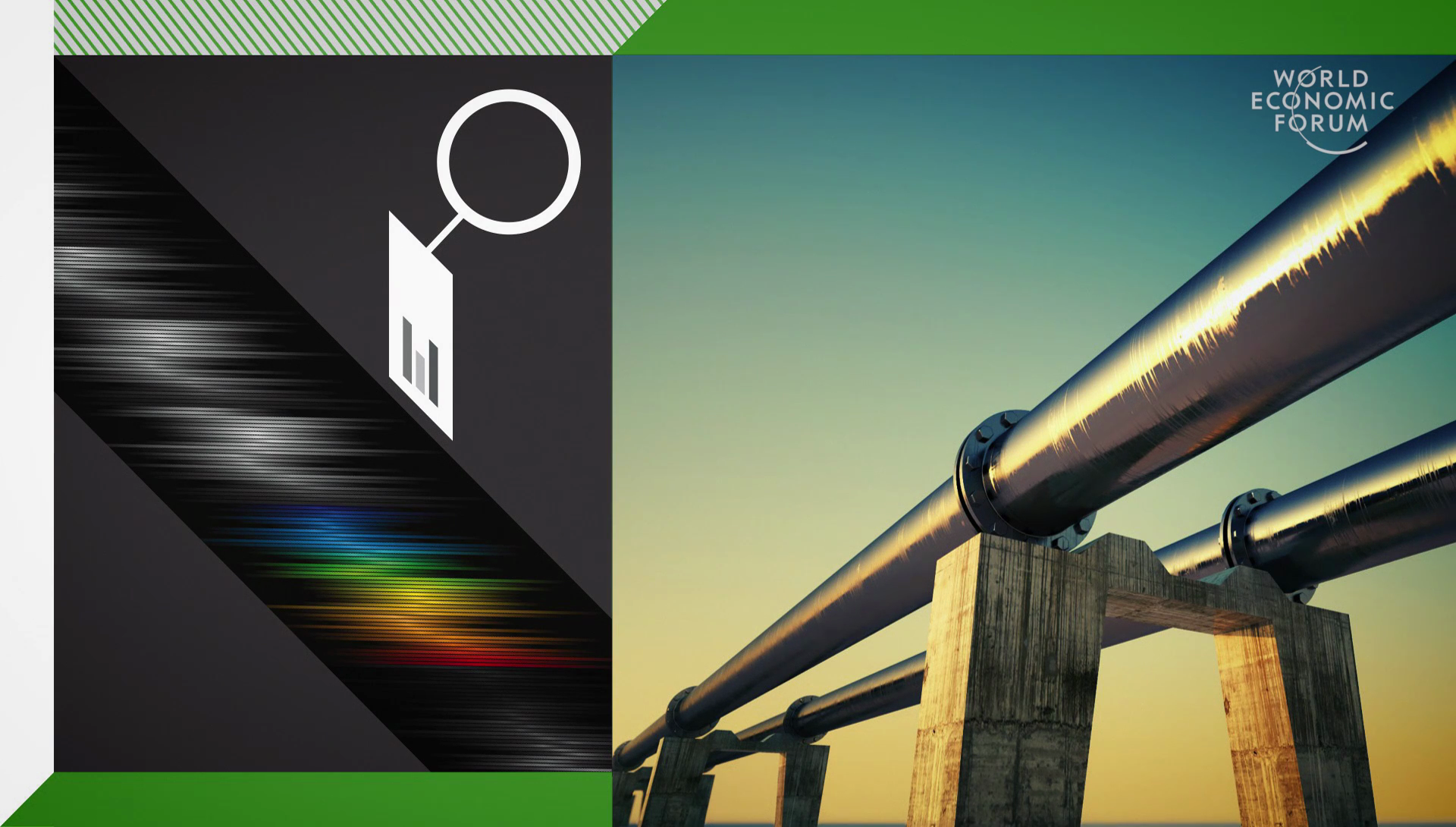
The colors of plants are ideal for our laser, but it’s not the only signatures that it’s limited to. It can also be used to monitor and also quantify trace gases. Imagine being able to accurately monitor pollution, from pipeline leaks to natural disasters, in real time. These developments promise future space-based platforms that could not only help to optimize global crop yields but also improve the accuracy of pollution monitoring. We can better be able to manage and understand our impact on the planet for the welfare of generations to come. This could help us reach our target of 70% more food by 2050.
Think about the way that high-resolution satellite maps like Google Earth have transformed navigation and are opening up new business models, for example Uber and self-driving cars. What if satellite-based laser imaging could do the same for farming?
Further Reference
Gabrielle Thomas at Imperial College
Annual Meeting of the New Champions 2016 at the World Economic Forum site