Jay Springett: You can find me online. I’m at @thejaymo. Professionally you can find me at The Ruderal. In my professional life, I work as a BizOps-type startup scaling consultant.
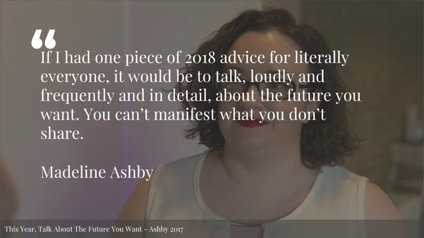
So, Madeline Ashby is a sci-fi writer and a futurist. And at the end of last year on her blog she wrote that her one piece of advice for 2018 is that we should talk loudly, frequently, and in detail about the futures that we want. And that kind of really will set the tone for the rest of talk. And I want you to kind of keep that in mind, that we should be speaking about the futures—with everybody that you come across—the kind of futures that we want, because it’s important.
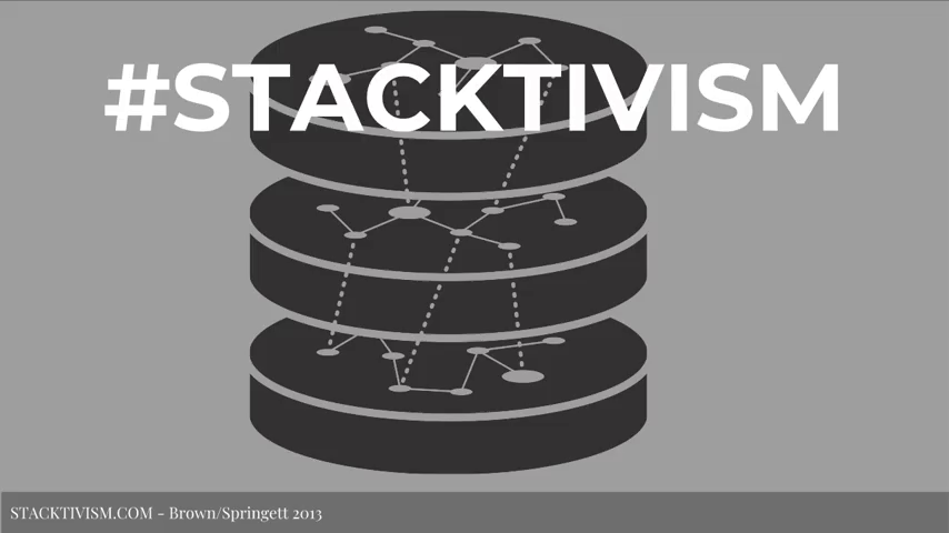
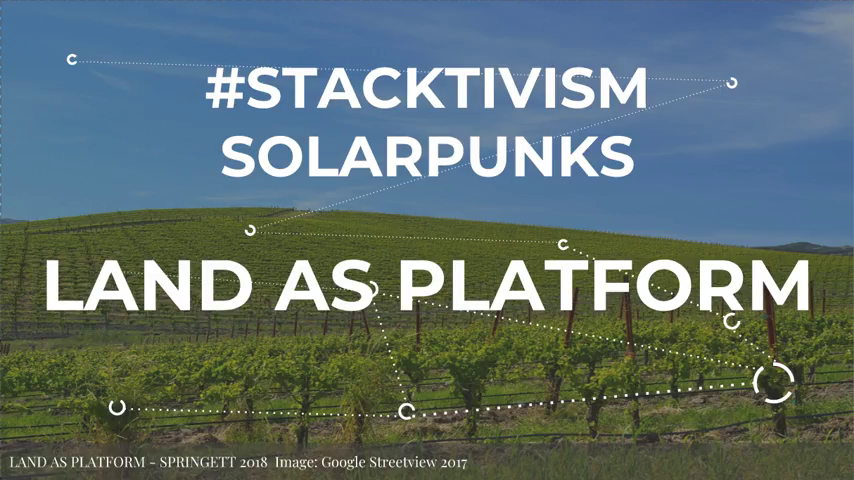
So I may be best known— I, for my sins, coined the term “stacktivism” earlier this decade, and have been interested in infrastructure and politics, and what it means. And kind of the thing that I perhaps am most known for tumbling out of this project is the term, “Who owns the means of not dying?” And that was kind of one of my principal concerns that falls out of infrastructure politics and how we think about technology.
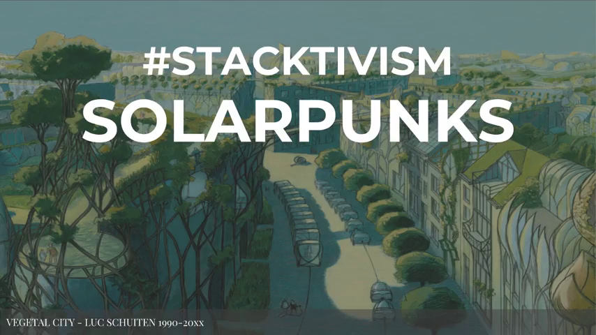
I’m also one of the admins on solarpunks.net which, if you don’t know about solarpunk, it is an emergent sci-fi genre which looks to imagine a bright green, non-dystopian future for everybody.

Right now, I’m working on a research project called Land As Platform which is kind of looking at the critiques that are currently being applied towards platforms like Google and Facebook as platforms, and taking the logic of the critique of platforms and applying it to land. What is the logic of a platform, as opposed to what we think about platforms being as like a multi-sided market, which is what we kind of currently understand platforms in 2018 to be. But if you say the word “land as platform,” I think you can kind of conjure an idea about what it is that I’m seeking to write about. And this is probably the first outing of Land As Platform kind of as a few fractured thoughts in this talk.
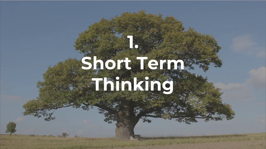
So I first of all want to talk about short-term thinking. Who works in tech? How many of you have two-week sprints? How many of you work on quality goals? Couple of you. Everyone has yearly goals at their companies, right?
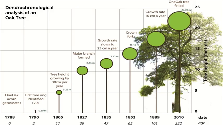
Well, when we think about short-term thinking, how short-term is short-term? Because if you plant a tree, like an oak tree, it takes 100 to 120 years for an oak tree to be fully grown. So anything between the point in which you plant the tree to when the tree is fully grown is short-term thinking, when we speak about land. Because we have to pass through that period. And talking about a hundred-year time scales for planning is not something that our culture is very good at. But we need to do that.
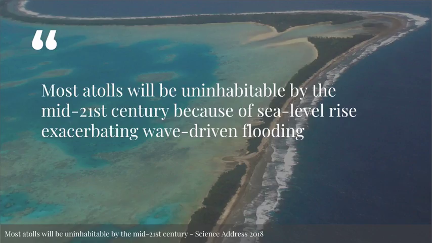
So, given that it takes 100 to 120 years for an oak tree to reach full height, what does it mean when most of the atolls in the world will be uninhabitable by the mid century? So we have fifty years until the waves take the islands. So we already have planning for 100 years, but we have climate disasters within fifty. So just framing the kind of concepts and the amount of time that these things take is important to get a handle on that.
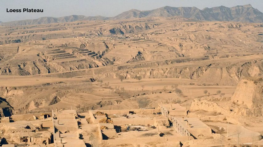
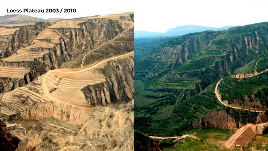
Speaking in longer terms, in terms of deep time, this is what 8,000 years of agriculture will do to a landscape. Does anyone know where the Loess Plateau is? Anyone know? So this is in China. This is where the terracotta warriors were found, and it’s where the Han Dynasty began. So if you farm a landscape for 8,000 years it ends up looking like this.
An interesting fact, I’m sure you all know about Petra in the Middle East. Petra did not desertify because the climate changed, it desertified because they cut down all the trees and changed the climate. So what do we do about this? Because these are man-made environments.
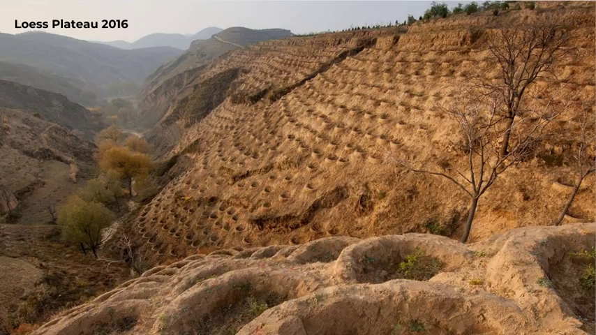
So this is an example of what’s going on. This is a picture from last year. And as you can see they’re planting these basins on the hillsides. So when it rains, the water tumbles down the hills and filled up the basins and is captured and then slowly sinks in once rain stops. And there a tree planted in each of these basins.
So it might not look very impressive, but given the right amount of planning and time, this is what you can do to a landscape. This is the biggest landscape regeneration project ever attempted by humanity, and it’s still very much short-term even if it does look regreened, because trees take 100 years to grow. It looks better, though. And I’m kind of down for that as a plan.
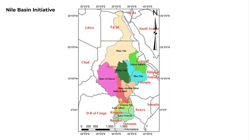
But these aren’t the only projects. There are bigger ones. There’s the Nile River Basin, the NBI project, which is going to be restoring all of the watersheds that feed the Nile, improving water quality, frequency of flow, reducing desertification upland, and also making sure that Egypt gets its continual flows. As part of this project they will be removing dams from the Nile. It is already in progress, the stuff that they can do, but there’s a lot of planning that still needs to be done in terms of how the project gets rolled out.
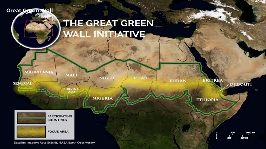
So that seems like a big project, but there are even bigger projects than this. The Great Green Wall of Africa project, which is the single biggest plan right now. It is a length of about seven and a half thousand kilometers. And the area in question that they are hoping to regreen to prevent the Sahara from desertifying further is 11 million hectares of land that is being planned and regreened.
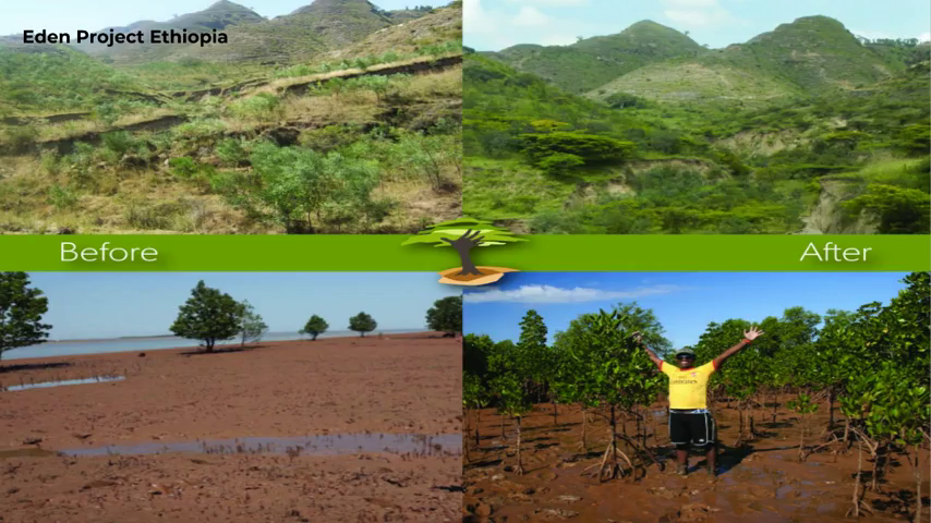
As part of both of these projects, Ethiopia as part of the Eden Project has already regreened one-sixth of its landmass. So, from the left to the right. And these projects are happening now, and I think it’s really important that those of us that don’t know anything about this do. Because this is very much what the future’s gonna look like. These are not natural spaces, these are now anthropogenic spaces. Humans have designed these spaces.
But in order to design these spaces we need to plan it. And I’m gonna give you a very brief overview of a thing called keyline design today, which works very much in Europe where it has rolling hills and not so many mountains.
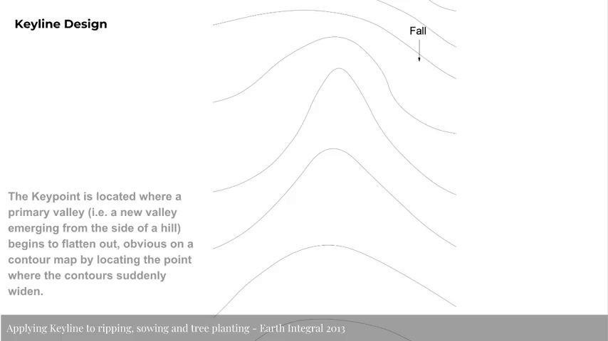
So this is a map. You can see the fall running from the highest to lowest. And to find a keypoint, it is the location where a primary valley emerges from the side of the hill and begins to flatten out. So if you can imagine rocks falling down a hill, at the point in which rocks first start to stop falling down a hill and land, that is a keypoint. And if you want to find a key point, if will you hold out your hands like this and press your finger up between your finger and the middle finger, you’ll see a little dent in your skin. That is the keypoint, it’s like a pond, essentially. It’s the highest point in the landscape where you can hold water. Does everyone get that?
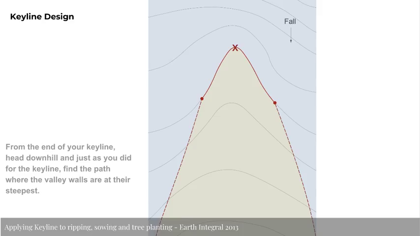
So we can identify a keypoint in the land. And then the contour line becomes the keyline in the landscape, which it’s highest point in the land that can hold water. And once we’ve found a keypoint, we can then abstract the idea of valleys and ridges and actually define where it is the valley walls start and where does the ridge end. Which if you were standing in the landscape is quite hard to identify, like where are the walls of the valley…where it shifts from being a ridge to a dale, let’s say.
So, we can identify these two different types of level in a landscape—ridges and dales. And then we can extrapolate out into a much larger map. So you can see here that there’s a primary valley and then there’s a secondary valley, and you have the red line which is the keyline that runs through the landscape.
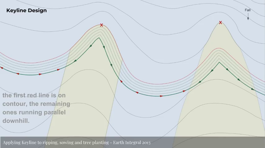
What you can then do is then you start to draw parallel lines on the landscape, both vertically up the hill and down the hill from your keypoint. And then there’s various things that you can do. It basically gives you a logic for laying out the land. You can plant trees on these lines. Or you can use a thing called a keyline plow, which is basically a t‑shaped plow that goes into the soil and explodes the subsurface. So when it rains the water runs into the ground and is soaked into the soil.
And what that does is means when it rains… You can see the directions of these arrows ice and it means that the water will run from the center of a valley out to the ridges. It’s not running uphill, but it is running out to the ridges. And water that lands on the ridges will flow into the valleys. Which means that you get a full coverage of water into a landscape and it’s far more efficient than just letting the rainwater run down the valley and cause erosion.
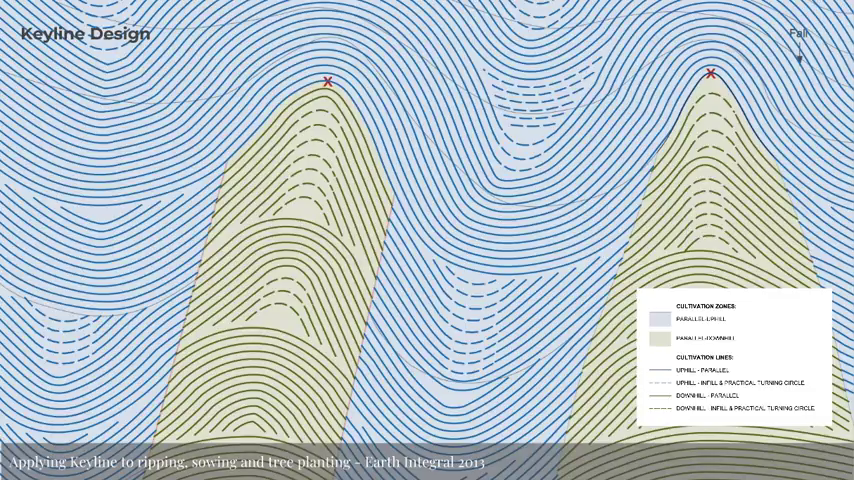
And then we extrapolate further, and you end up with, you know, at a high level a keyline plan for the landscape. Keyline also allows you to dictate where you can put roads in order to best prevent erosion and water movement through the landscape. But essentially, if you were looking at maps, this is a keylined plan for the landscape.
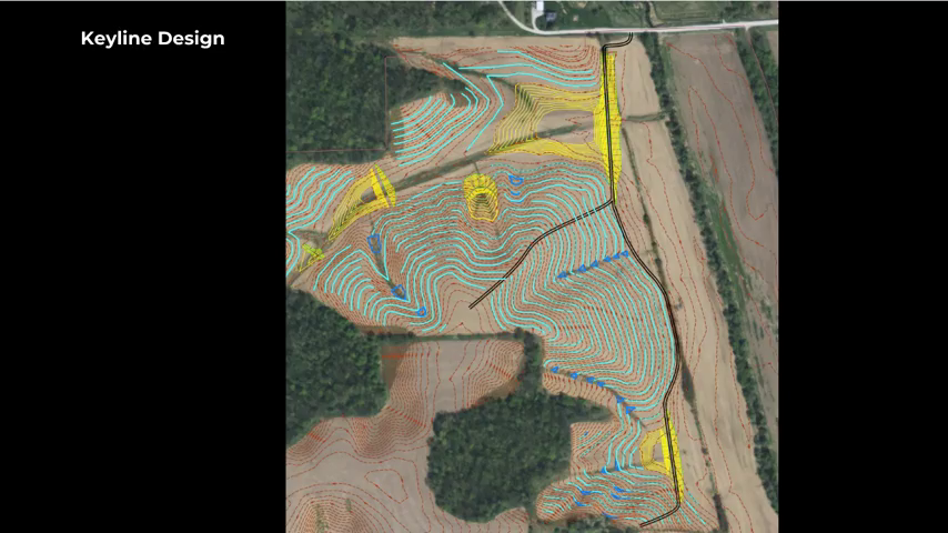
But you can zoom in. And this is an actual keyline plan for a farm. So if you were to zoom in on Google Maps, obviously it’s like a fractal landscape because you will find smaller keypoints within landscapes. So you can see here this landscape has got designations where they’re going to be growing trees; it’s the yellow. You’ve got the keyline rip lines, which is the blue where the water’s going to go. And you can also see they’ve got places where ponds will naturally form from rainwater. And these are known as pocket ponds rather than large ponds. So if you’ve got a couple of acres you can lay out your landscape to best optimize water flow.
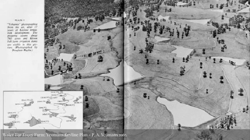
This is the first keylined landscape, from 1965. PA Yeomans is Australian—or was an Australian farmer who invented keyline. And you can see here that there’s all the dams on the landscape holding water and allowing for flood irrigation and stuff like that.
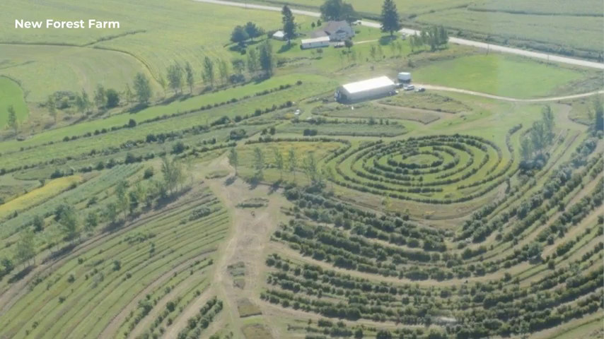
But what does it actually mean to talk about a landscape that has been designed in this way? This is New Forest Farm in the States. And this is what a keylined landscape looks like. I think it looks pretty cool compared to square industrial farming fields that we’re kind of used to. So this is a keylined landscape, and it’s kind of what the future is going to look like, I think.
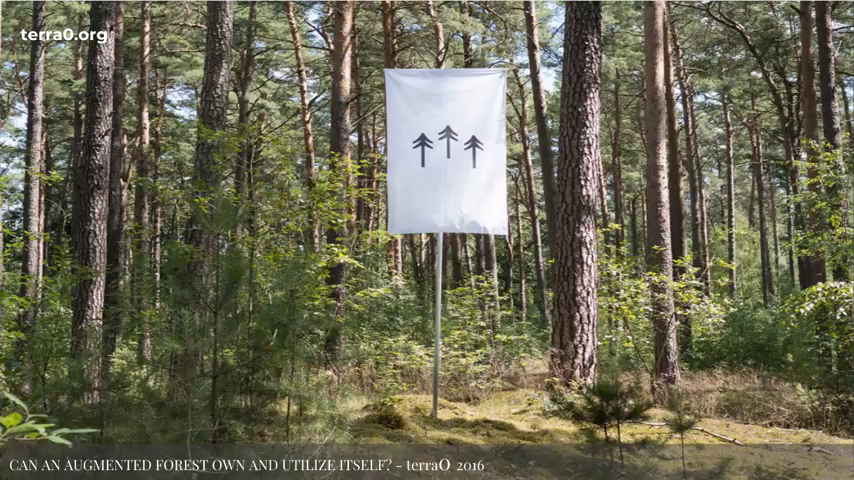
So on the inverse, in the very short term, what is technology bringing, and what does say the next ten, fifteen years look like in terms of technology? Well, they’re in the audience today, but there’s terra0 who are based here at Trust. And they are a blockchain startup that attempts to kind of wrestle with the question, can an augmented forest own and utilize itself? And behind here is the grow wall for their test stuff that they’ll be doing. Maybe they can speak about that a bit later.
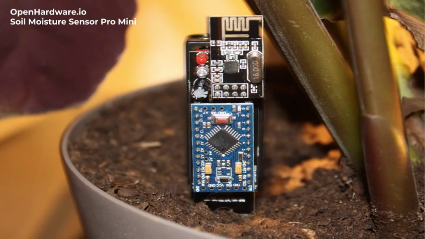
But in order to think about a forest that is gonna utilize itself, it needs a lot of deep sensing data in order to inform its decisions about… Or, we need deep sensing data in order to inform the decisions that we need to take about the landscape. At the moment you’ve got stuff like ‚this which is a soil moisture sensor from OpenHardware. It’s two AA batteries. Very cheap if you buy them in bulk. But they still require batteries. And there’s also carbon sensors, soil pH testers, moisture testers, all various things that you would expect coming out of the open hardware movement. But they’re all individual sensors that require batteries at the moment.
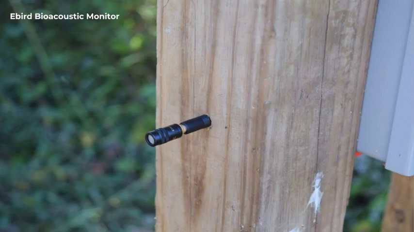
There’s also things like this, which is the Ebird monitor, which can be placed around the landscape and plotted on a map. These things can record over a million hours of sound. Then they run it through machine learning and can identify biodiversity of birds in the landscape, because machine learning listens to the birdsong and extrapolates how many birds there are in a certain region, etc. Again, they have to be powered, which is a bit of a problem. So we need to start thinking about how do we bring all of these various sensing devices together, and what does it look like when we do.
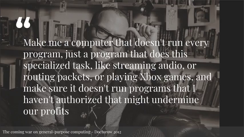
So we’ve kind of reached a point in 2018 where we’ve reached the end of general-purpose computing. If you’re not familiar with the term, then Cory Doctorow wrote a fantastic essay in 2012 about the end of general-purpose computing, and you can read the danger up top. Basically it’s the idea that you can’t run code on a device unless it’s either signed, or you have permission to do so.
Some of the practical implications of this is like, self-driving cars can only run code that is signed because you wouldn’t want people you know, installing modules onto self-driving cars and deliberately driving into people rather than avoiding them, for example.
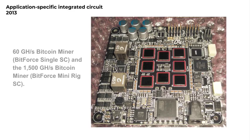
The second part of the end of general-purpose computing is a thing called ASICs. Does anyone know what an ASIC chip is in the audience, hands up? Alright, not that many. I’ll seek to explain. So an ASIC chip is a chip that is only designed to do one thing. So it doesn’t run code in the same way as you would assume code to be run, where you can just run all sorts of computation and code. An ASIC chip will only run what it’s physically designed to run. And in 2013, this is the Butterfly Labs bitcoin-mining rig. It was one of the first kind of drives forward in the open source ASIC space. Because all that these chips did was mine Bitcoin. They couldn’t do anything else. They’re modified GPU chips.
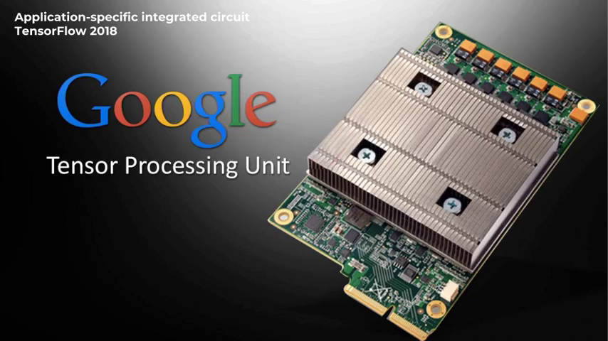
But what it’s meant in this kind of pushing forward of chip design is that we now have things like this, which is Google’s TensorFlow. These units only run neural nets. So if you’re doing machine learning, they don’t run any other code except the code required to train neural networks.
Advantages of this is that the code only runs on the chips. It also means you get a massive power saving, because it can only do what you’re asking the chip to do and it doesn’t have all of the overheads of trying to do computations in a general way. It’s very specific and targeted.
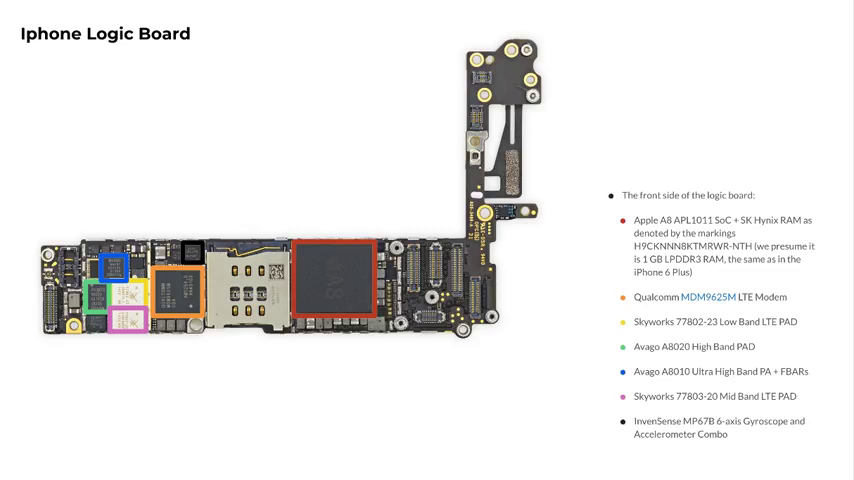
One of the other places that you’ll find ASIC chips everywhere is inside mobile phones. And it’s very unclear where iOS on your mobile phone ends and the hardware begins. So for example, all of your MP3s, MPEGs, JPEGs, are all decoded in hardware on tiny chips on the motherboard, not in software. So, those tiny chips only decode video, for example. And this is what is also driving the ASIC space, is the miniaturization of mobile phones.
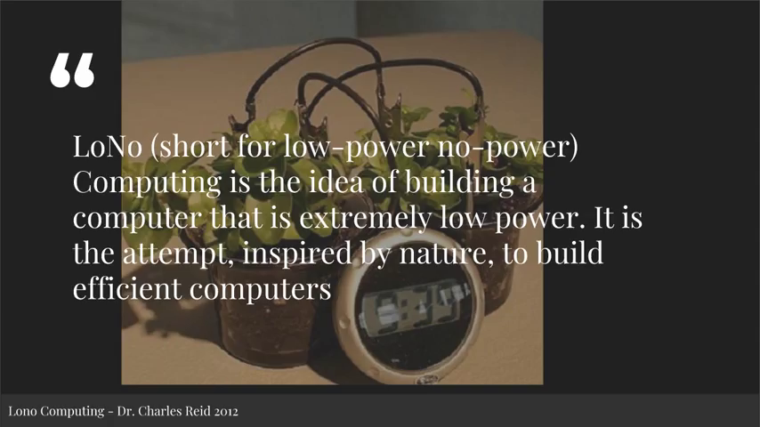
In the early days of solarpunk, there was a talk given on low- or no-power computing. So as you can see here there’s like, a soil clock. I’m sure you used to make potato clocks as a kid, where you could power a potato. Well you can also do the same thing with soil. You can run devices from soil.
So what do deep sensing devices look like when they’re that low-power that you don’t need to have a battery is a question. Can we get there? Maybe. But we need to have a think about if we’re gonna be deploying all of these sensor devices on a landscape, what does it kind of look like? How often you have to go change a battery? If you’ve got like thirty hectares of land, there’s no way that you want to go walk or get on a quad bike to go to the other end of your land if you’re a farmer to change the battery in a sensing device. Because that’s like— Especially if it’s like once every six months. That’s madness. People are too busy on farms to be changing batteries in devices.
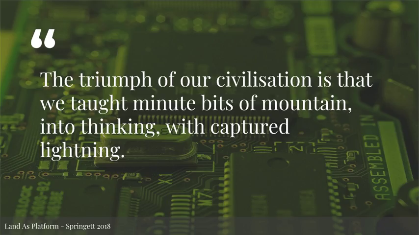
So when we try and put these things together, the idea of land as platform and deep sensing, what does it look like? So I heard a bit of… One of the most ridiculous things I’ve ever heard I heard the other day, a blockchain conference, where someone said that the invention of the blockchain is our generation’s pyramids. But I would like to contend that the triumph of our civilization, with ASIC chips and so on and so forth, is that we will teach minute bits of mountain into thinking with captured lightning. Because they will be thinking machines at that point. Not in the way that we perceive thinking in terms of AI, but it will literally be a slab of materials that only do one thing and they think. And they give us sensing data.
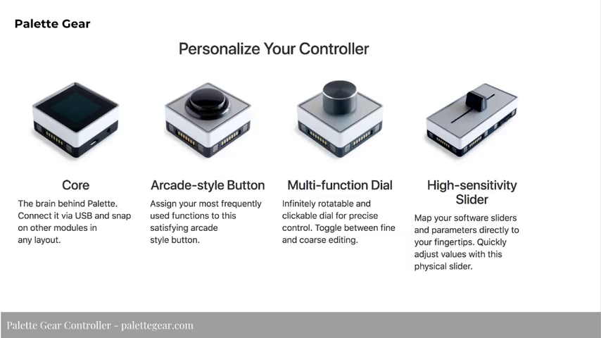
But what do these devices look like? Well, I don’t know if you make music but there’s like Palette Gear is probably like the nicest design objects out there. These are MIDI controllers that you can just click together and build a board of all of your differently MIDI controllers.
So I’m imagining that sensor platforms, or deep sensing platforms, will be one platform that goes in the grounds and then you can just connect modules on depending on what sensors you want. And obviously when you put a sensor on you’re going to have a deeper power load on the particular sensor.
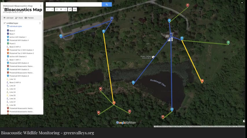
Bioacoustic Wildlife Monitoring, Green Valleys Watershed Association
So, the Ebird installations kind of look like this. You can’t really see the map but you can kind of see how it works. So at the moment it’s all powered by base stations. And each one needs to be powered and there’s wifi networks that then ship all the data backwards and forwards. And because they know where they are in the landscape they can also triangulate where the birds are on the landscape.
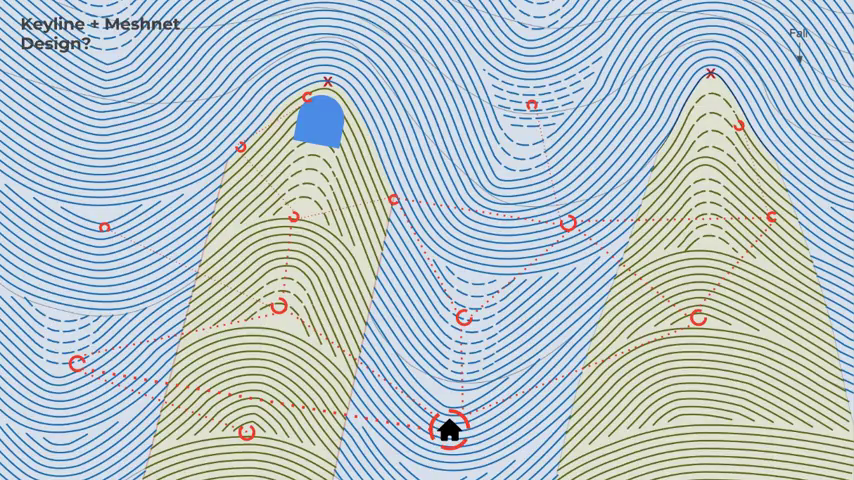
So one of the applications this, and why I’m here speaking at Peer-to-Peer Web is mesh networks. What does it look like when we start to think about connecting, or planning for, sensor data with mesh networks that allow for much smoother communication routes in terms of its information? What happens when mesh networks start thinking in terms of land as platform?
And this is where I feel like I went off the deep end a little bit when I was making this slide, because it kind of looks like art rather than a diagram. But, the idea here would be mesh network protocols have to have an understanding of how we’re going to be laying out the land. Because if that’s where I live, there’s no way I want to go all the way up there to change a battery in a router. So how do these mesh networks work in the landscape? How often do they ping each other, how often do they pass information through the mesh? How often do you even need information from certain sensors? Is it once a week, is it once a month? All of these things can be baked into the power considerations of how mesh networks work.
And yeah, so that’s the final slide. And that’s land as kind of the…the land as platform. Thanks.
Further Reference
Peer-to-Peer Web Berlin event page